If you’ve been watching Oconomowoc Lake and wondering why so few shoreline listings hit the market, you’re not imagining it. This is a large, sought-after lake with tight local rules that keep parcels big and change slow. When you understand those rules, you can plan your move with confidence and avoid costly surprises. Here’s how shoreland zoning shapes supply on Oconomowoc Lake, plus what to watch for as a buyer or seller. Let’s dive in.
Oconomowoc Lake snapshot
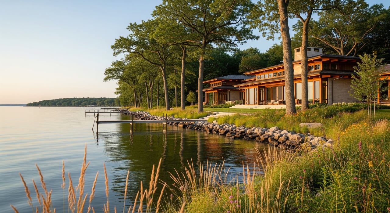
Oconomowoc Lake spans about 818 acres with a maximum depth near 60 feet, according to the Wisconsin DNR’s lake facts page. You’ll find a mature shoreline within an incorporated village, which means established homes, limited vacant land, and very careful growth. That setting drives strong demand and low turnover for true lakefront parcels. You can review basic lake data on the DNR’s Oconomowoc Lake facts page for quick context.
- Learn more: see the DNR’s lake facts for Oconomowoc Lake (WBIC 849600) for acreage and depth details. (WDNR lake facts)
Who sets shoreland rules
Multiple layers guide what you can build and where:
- Village of Oconomowoc Lake. Inside the village, the local zoning code controls lot sizes, waterfront setbacks, vegetative buffers, design review, and accessory limits. See Chapter 17 of the zoning code for the rules that apply to most lakefront owners. (Village Zoning Code, Chapter 17)
- State shoreland standards. Wisconsin’s NR 115 sets minimum shoreland protections such as setbacks, nonconforming structure limits, and impervious surface caps that local codes must meet or exceed. (NR 115 text)
- DNR waterways permits. Anything waterward of the ordinary high water mark, like docks, boathouses, riprap, or dredging, is regulated by the DNR. Many projects need a waterways permit unless they fit narrow exemptions. (DNR waterways permit FAQ)
- Waukesha County. The county administers shoreland rules in unincorporated areas. Inside the village, local rules apply, though county resources and maps remain useful. (County shoreland program)
Rules that shape supply
Local standards are designed to protect the lake and its character. They also limit how many lakefront lots can legally exist and what redevelopment looks like.
Minimum lot size and width
- In R-1 areas, waterfront parcels often need a minimum 250 feet of frontage and about 5 acres, which prevents slicing long stretches of shoreline into many small lots.
- In R-3, minimums are still significant, with examples like 120 feet of width and 30,000 square feet of area.
- Bottom line: larger minimums mean fewer potential new lots from any given shoreline.
- Source: dimensional tables and district standards in the village code. (Village Zoning Code, Chapter 17)
Setbacks and buffers
- A required vegetative buffer typically extends 35 feet inland from the ordinary high water mark, with limited viewing corridors.
- Waterfront setbacks for principal and accessory structures commonly range from 50 to 75 feet by district.
- Setback averaging may apply in established areas, but reductions are limited. The net effect is less buildable area near the water and fewer practical ways to split lots. (Village Zoning Code, Chapter 17)
Impervious and floor area
- State shoreland rules cap impervious surfaces in most cases, with higher coverage only through specific pathways and mitigation. (NR 115 text)
- Locally, floor area and accessory limits work in tandem with coverage caps. For example, total first-floor area for accessory buildings is limited as a percentage of lot area in some districts.
- These controls prevent overbuilding and keep density low.
Height, width, and design review
- The code caps height and limits the principal structure width to a fraction of lot width near the shoreline, often no more than 60 percent within 150 feet of the water.
- The Architectural Control Board reviews design to maintain a natural appearance from the lake. This makes intensive infill and maxed-out rebuilds less likely. (Village Zoning Code, Chapter 17)
Waterward permits and timelines
- Piers, boathouses, beach fill, riprap, and dredging may require DNR review. Even when allowed, permitting can add time and cost, which also slows new-lot creation. (DNR waterways permit FAQ)
Land division and sewer rules
- The village’s land-division rules govern Certified Survey Maps and plats, with conditions that restrict when legal nonconforming lots may be split.
- Where public sewer is available, connection is often required. Sewer can remove septic constraints, but minimum lot sizes and frontage standards still control density. (Village ordinance index)
Buyer takeaways
You are entering a low-turnover, low-density market. Preparation helps you act fast and protect your goals.
- Confirm jurisdiction and zoning district early. Verify if the parcel is inside the village and which district applies. (Village zoning resources)
- Ask about frontage and lot area. Do they meet current minimums if you plan to rebuild or split?
- Check setbacks, buffers, and any mapped wetlands or floodplain.
- Review coverage and floor area limits if you want to expand.
- Clarify sewer availability and any connection requirements.
- If you want a pier or shoreline work, review DNR permit paths.
Quick due diligence checklist:
- Zoning district and legal lot status
- Lot width, area, and lake frontage measurements
- Shoreland setback and vegetative buffer location
- Impervious surface and floor-area allowances
- Sewer availability and any required hookups
- DNR permitting needs for piers or shoreline work
Seller takeaways
If you plan to list, rebuild, or split, start with the rules. It can save months.
- Pull the zoning map, parcel dimensions, and any prior approvals.
- Map setbacks, buffers, wetlands, and the ordinary high water mark.
- If considering a split, test whether new lots would meet width and area minimums and land-division procedures.
- Anticipate review by the Plan Commission or Architectural Control Board for design-sensitive projects.
- If a pier or shoreline work adds value to the sale, confirm the DNR path and timeline up front.
Strategy and timing tips
- Expect fewer, slower, and more curated opportunities on the lakefront. Many owners renovate within existing envelopes rather than pursue major splits.
- Strong preparation helps you compete. Clear surveys, zoning summaries, and permit-status notes can make a listing more attractive and reduce buyer uncertainty.
- Be flexible on timing. Discretionary reviews and multi-agency permits can stretch schedules.
Work with a lake specialist
Reading the code is one thing. Translating it to your specific shoreline is another. With deep, lake-by-lake experience in Oconomowoc Lake and Lake Country, we help you weigh setbacks, frontage, buffers, coverage, and design review against your goals, then craft a plan that fits the rules and the market. From pricing and premium presentation to experiential showings and on-the-water context, you get clear guidance at every step.
Ready to buy, sell, or evaluate options on Oconomowoc Lake? Connect with Kimberly Stark of Kimberly and Co. Real Estate for local insight and a plan that works.
FAQs
Can you split a lakefront parcel in the Village?
- Possibly, but only if the resulting lots meet minimum frontage and area, comply with land-division procedures, and avoid wetlands or floodplain; additional approvals may be required. (Village Zoning Code, Chapter 17)
How close to the water can you build on Oconomowoc Lake?
- Waterfront setbacks commonly range from 50 to 75 feet by district, with limited averaging in established areas and a required 35-foot vegetative buffer. (Village Zoning Code, Chapter 17)
Do you need a permit for a new pier or boathouse?
- Often yes; the DNR regulates waterward structures and many projects need a waterways permit unless they qualify for exemptions. (DNR waterways permit FAQ)
Are there limits on removing shoreline trees and plants?
- Yes; the village requires a vegetative buffer near the shore with narrow viewing corridors, and state shoreland rules restrict removal without proper approvals. (Village Zoning Code, Chapter 17)
Who do you contact for permits and questions?
- For landward work inside the village, start with Village staff and the local code; for waterward work, see the DNR’s waterways guidance; county rules apply mainly in unincorporated areas. (Village zoning resources)